
News
Waste management service provider, Pikitup, has commissioned the CSIR to investigate potential regulatory or economic interventions that will encourage more people in residential areas to participate in a waste-separation-at-source programme in Johannesburg. Participation by households has been low since the programme’s inception.
Proposals are hereby invited for the following two separate and independent elements within the RIS:
- Regional Innovation Networking platforms (aimed at establishing a networking platform to bring together research, development and innovation communities, technology SMMEs, industry and government.
- Feasibility study or business plan support for technology incubators, science parks or other innovation enabling mechanisms.
The successful consortia will work closely with the Technology Localisation Implementation Unit (TLIU) as implementing agency on behalf of DST for the RIS programme. Read more...
“Through the Habitable Planet Workshops, I realised that there is a purpose out there for this young black girl from the deep rural farms of the Eastern Cape,” said Zanele Xelelo, a long-standing participant of the Applied Centre for Climate and Earth System Science’s (ACCESS) Habitable Planet Workshops. Xelelo spoke at the 10-year celebratory dinner of the Habitable Planet Workshop (HPW) series held at various locations across the country on 17 January 2018.
CSIR earth observation experts are making significant contributions to a global consortium that is set to deliver data, models and knowledge that will improve the management of 23 protected areas across the globe – of which the Kruger National Park is one.
Ecopotential is funded by the European Union and has 47 international collaborators. The Ecopotential partners are tasked with delivering earth observation products that will contribute to understanding and monitoring changes to ecosystems while supporting the effective management of protected areas.
The CSIR has developed a modelling capability that can help municipalities adapt to climate change and associated rises in temperature. This is done by combining information from temperature projections and detailed information of urban surfaces, such as roads and buildings, using the city spatial development plan in that region.
CSIR researchers at the Southern Ocean Carbon & Climate Observatory (SOCCO) will put five years of climate and ocean study to the test as part of the international Good Hope-SOSCEx 2019 Experiment. Dr Pedro Monteiro hopes that the outcome of this coordinated South African polar community experiment will improve climate projections for the rest of the century, an important step for local and global climate mitigation and adaptation.
The CSIR corporate functions Bursary Programme aims to build a pipeline and strengthen capabilities in the corporate functions to ensure business excellence that will forster a conducive environment for the Research, Development and Innovation work to thrive. This bursary is open to academically qualifying young people and also aims to attract and increase participation of women and black people. The CSIR hereby invites bursary applications from talented young people wishing to pursue their studies. Read more...
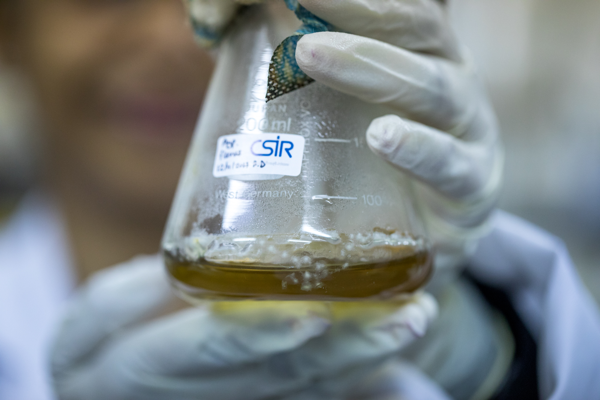
CSIR researchers are producing mycotoxins that will support the National Metrology Institute of South Africa (NMISA) to provide more affordable and easily accessible measurement standards for mycotoxin testing by laboratories locally and on the continent.
CSIR geospatial experts have helped government assess the location of magisterial district courts in an effort to ease the access to courts.
Infrastructure is a key part of improving service delivery. However, the spatial distribution of infrastructure must be based on where people live and where they can best access such services. To support this objective, the CSIR has undertaken geospatial accessibility analyses for a range of purposes.