What we do
Mining testing and training
Our testing and training services are tailored to support the mining industry's zero-harm goal. With state-of-the art facilities, we deliver high-quality services in mechanical testing, emergency breathing equipment and mine fire and explosion safety. We help clients reduce the risk of harm arising from equipment failures or catastrophic accidents.
Contact information:
Highlights
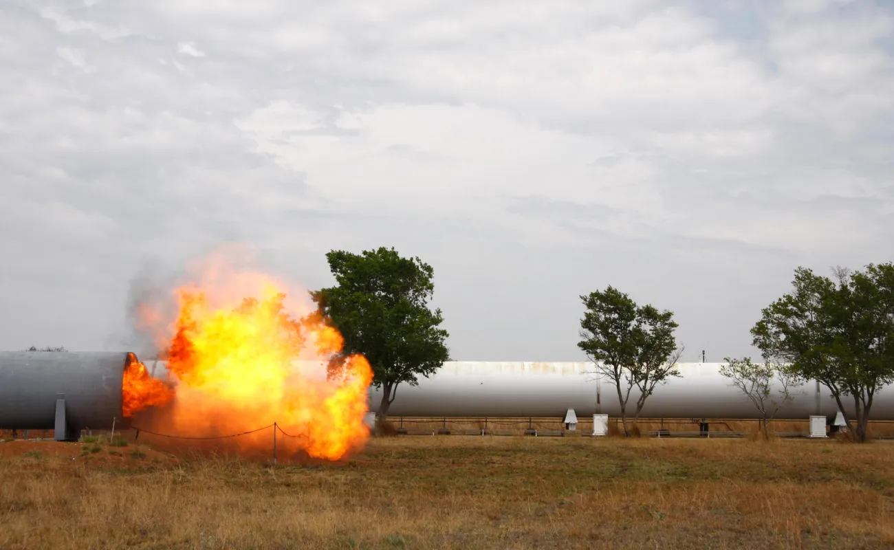
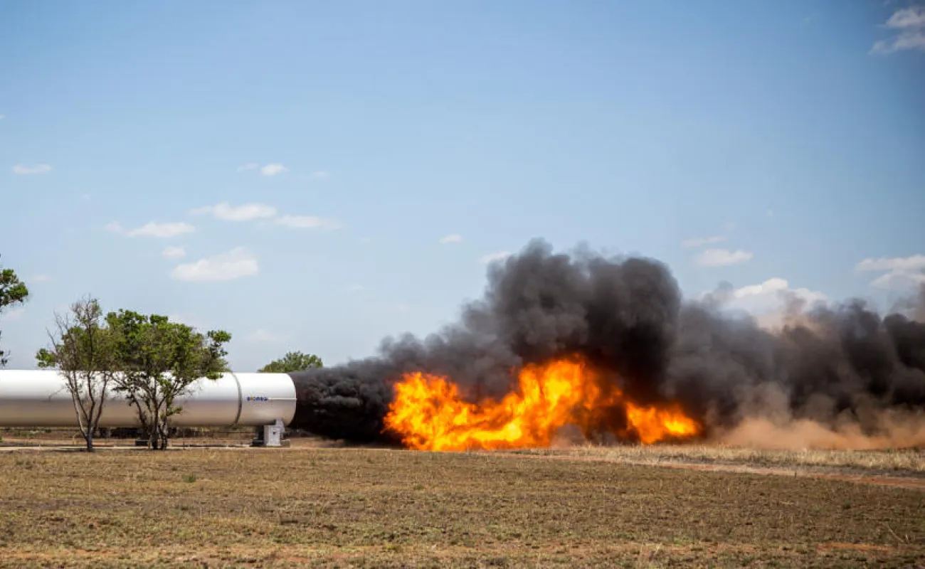
Understanding suppression of fire for safer underground mobility: A nine-ton flameball
The CSIR conducted a first-of-its-kind fire characterisation test on a full-scale mine locomotive and battery, weighing approximately nine tonnes. In partnership with Sibanye-Stillwater, Trident SA and Mines Rescue Services, the aim was to characterise fire behaviour and identify the most effective suppression methods. A series of large-scale fire exposure tests were carried out on lithium-iron-phosphate battery assemblies, which are increasingly used as a safer, more sustainable alternative to conventional lead-acid batteries for powering underground mining locomotives. The tests, undertaken at the CSIR’s specialised fire and explosion test facility as Kloppersbos, generated data that supports CSIR research on underground fires.
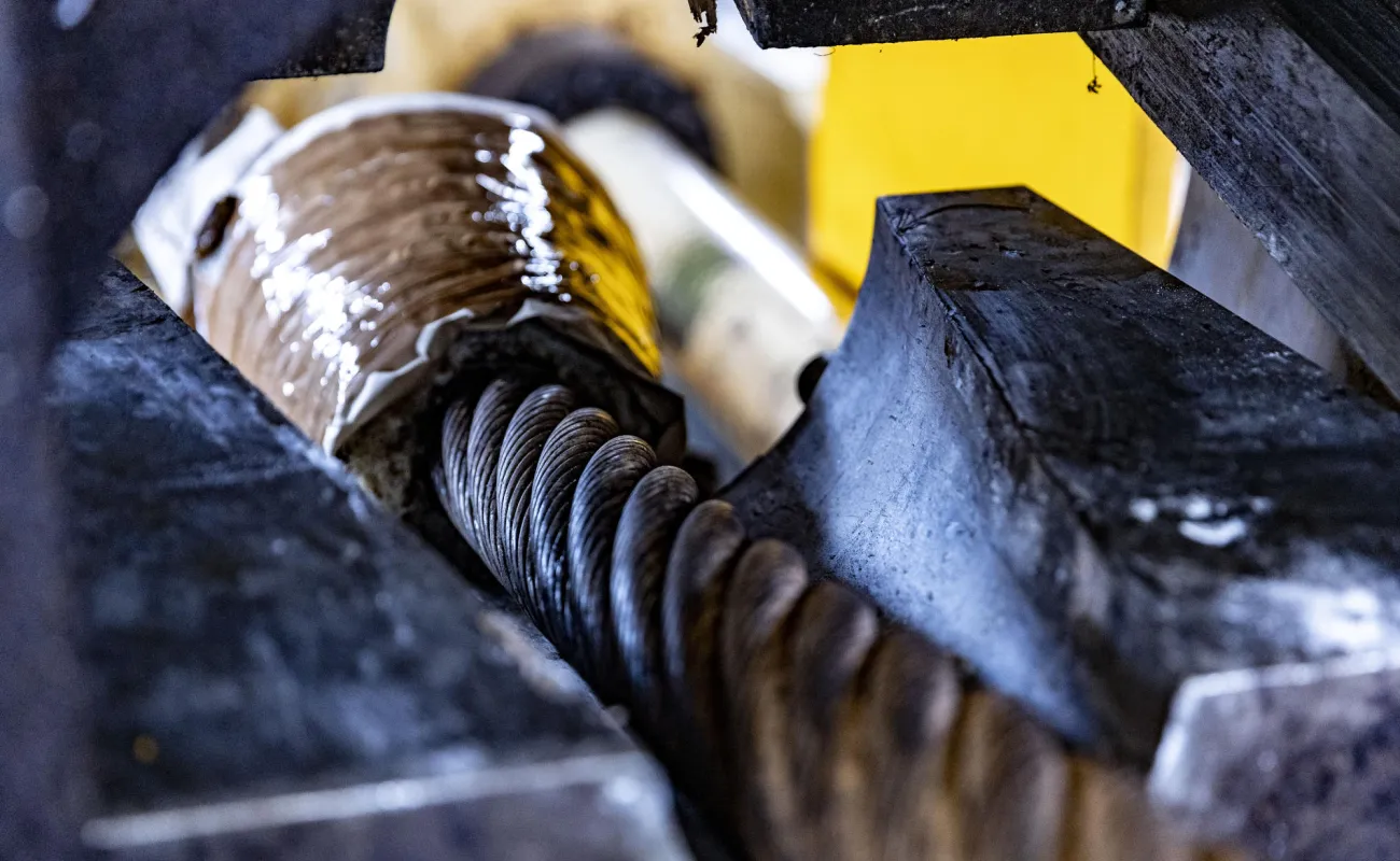
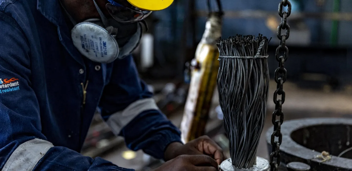
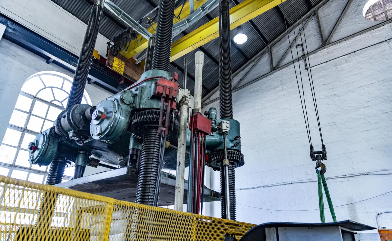
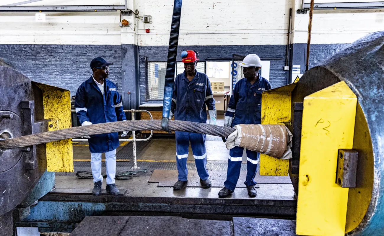
Nine decades of testing to ensure worker safety
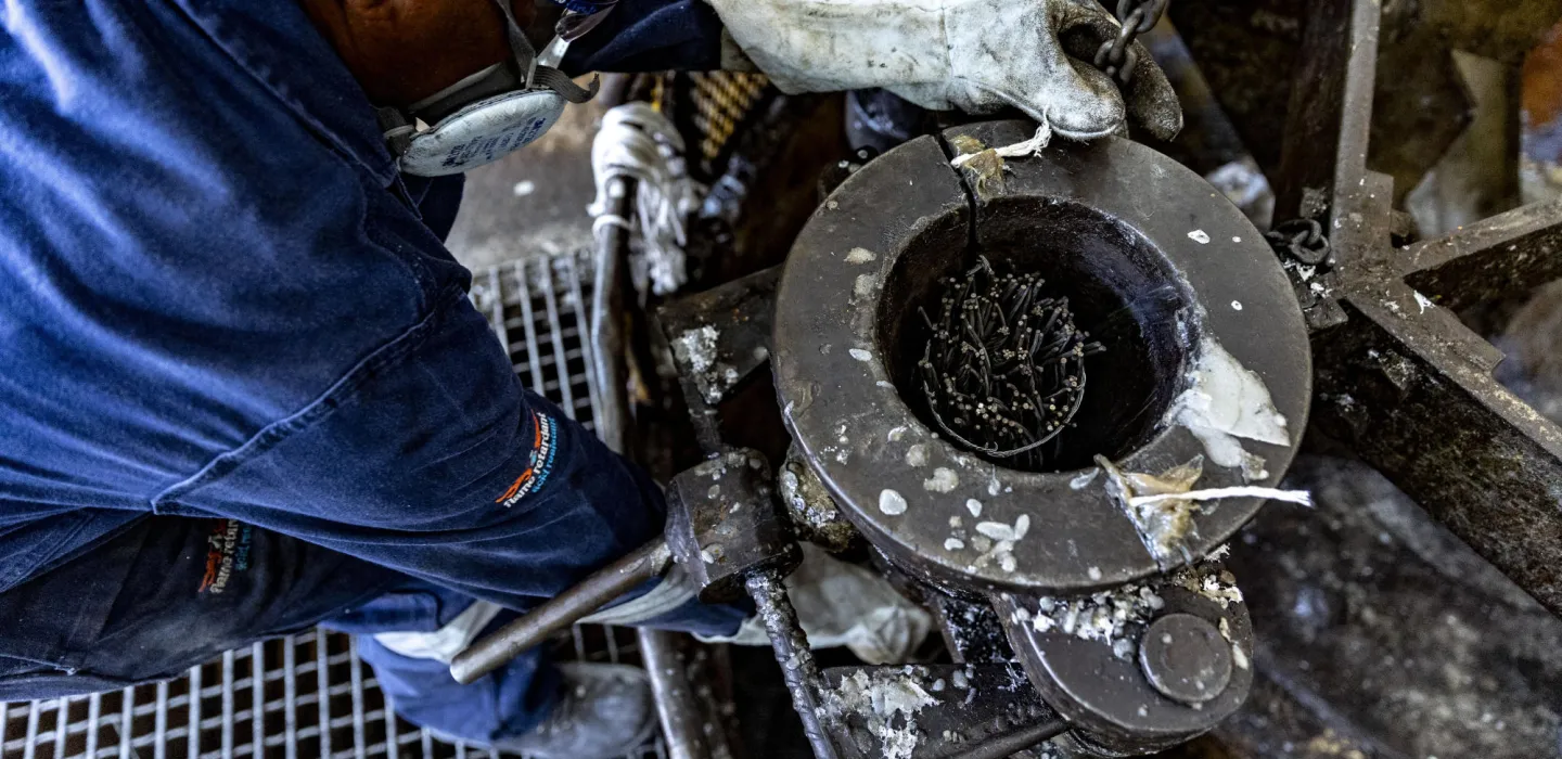
Our rope testing laboratory is equipped to handle a range of rope diameters and conduct breaking strength tests. A tragic accident and loss of lives in the early 1900s led to the introduction of statutory testing for such ropes and the facility was established in 1935. Ninety years later, it continues to support the mining, manufacturing, construction, engineering and other industries, ensuring the integrity of hoisting equipment and contributing to overall worker safety.
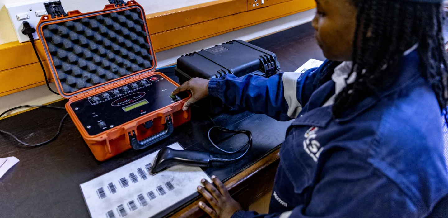
Our services
Our services include tensile testing of steel wire ropes, conveyor belt splices and proof load testing, as well as failure inspections and investigations. A comprehensive database of testing records is maintained for reference purposes. Watch what happens at the laboratory.
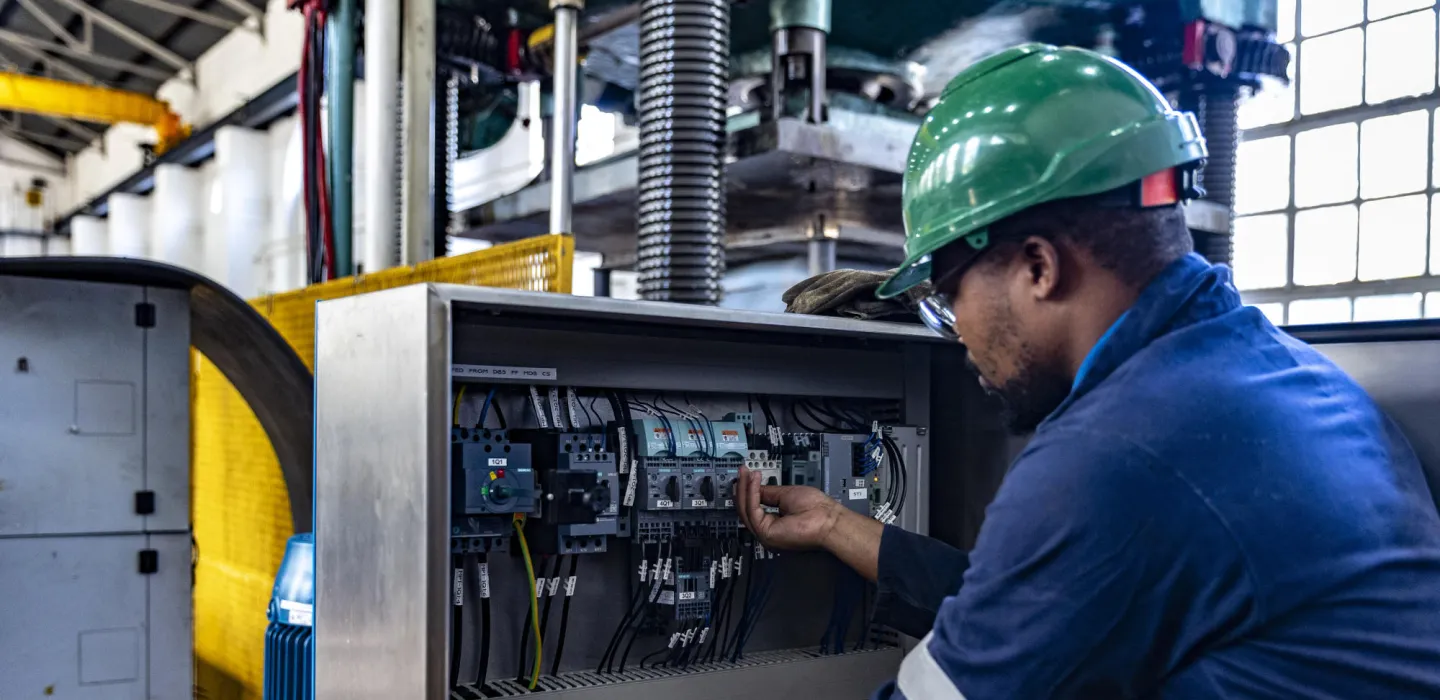
As strategic support partner to industry and the state, we have a track record spanning many decades of delivering essential services that ensure legislative compliance and protect worker safety.
Our services include:
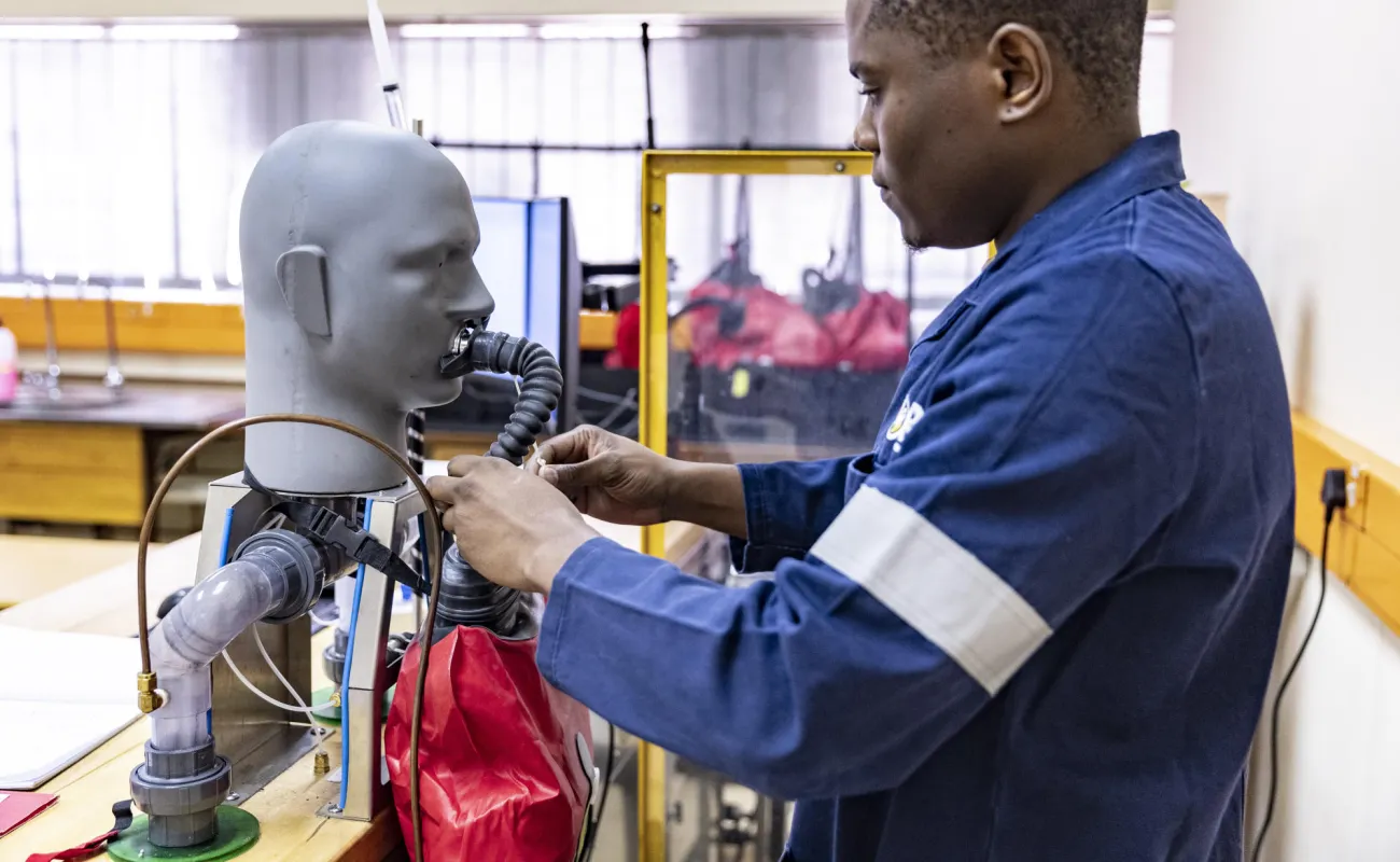
Annual monitoring and legislated performance acceptance testing for self-contained self- rescuers
Bi-annual, legislated destructive tensile testing of mine winder ropes
Monitoring and analysis of industrial air pollution
Mine fire and explosion suppression testing
Competency-based training using fourth industrial revolution (4IR) technologies
Our facilities
Resources
VR-enhanced safety training delivers experiential impact
Enhancing our training material with the power of virtual reality gives mining employees a realistic sense of emergency scenarios. The simulated, immersive training environment provides a competency-based reskilling method for workers and encourages the application and adoption of 4IR solutions in the mining industry.