Stanford, Franschhoek and Pearly Beach are among the most damaged regions in the Western Cape following wildfires in January 2026. The CSIR has released satellite imagery revealing the extent of the destruction and can support authorities with damage assessments and future disaster planning.
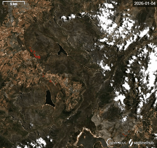
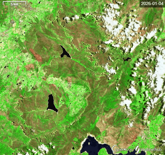
Western Cape burn area: a timelapse showing large patches of burn area emerging as fires raged across the province during January 2026.
CSIR researchers sourced Copernicus Sentinel-2 satellite data via the Sentinel Hub to show healthy, denser vegetation in vibrant green, while
dry or sparse vegetation is shown as sandy brown and clouds are white. Fresh burn scars are rusty brown, while older burn scars appear dark brown,
turning lighter as some vegetation recovery begins.
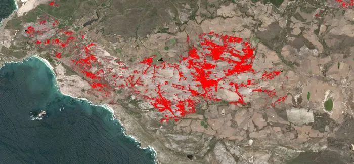
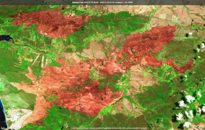
Franschhoek burn area: the CSIR visualised burn areas over January 2026 in two different ways. Left: data from the Sentinel-2 satellite shows
a timelapse of scarred earth in red from the beginning of January to the end. Right: extensive burn scars are seen extremely close to farmlands and
populated areas, indicating that better vegetation management may be needed in future to prevent from fires spreading so close to settlements in high winds.
In the affected Western Cape areas, burn area data from satellites are particularly useful for farmers to see where winelands have been destroyed and where horticulture or viticulture is damaged. Satellite imagery can also inform future disaster planning, and help to monitor regrowth and biodiversity impacts, particularly in the sensitive or protected ecosystems of the Western Cape. It can also be used to calculate the precise area of damage.
The CSIR cautions, however, that this type of satellite data on its own cannot be used to determine the cause nor can it be used as stand-alone evidence in legal or insurance claims. Rather, satellite and burn area data can support field investigations and other data sources.
The CSIR Advanced Fire Information System provides ongoing fire monitoring and early-warnings for South Africa, and the CSIR invites municipalities and other authorities to get in touch for assistance with damage assessments and future fire disaster planning at @email.
Published 09 February 2026